In the early hours of 4 February 1945 two Australian commandos, Alex Chew and Bill Jinkins, paddled away from an American submarine, the USS Pargo, and landed on Woody Island in the Paracels. In the weeks beforehand, American airmen had reported seeing a French tricolour flying on the island and ‘Z Force’ had been tasked to investigate. Chew and Jinkins discovered there were indeed French people on the island but also Japanese sailors and so retreated to the sub. The Pargo surfaced and shelled the buildings for several minutes. The first ‘Battle of the Paracels’ was a one-sided affair.[1]
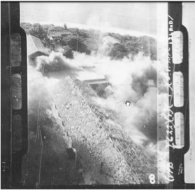
A separate mission to Japanese-occupied Itu Aba a month earlier hadn’t been so successful. Two other Australian commandos, launched from the USS Bream, had been unable to plant their explosives and retreated. Instead the island was hit from the air. On 1 May 1945 American planes tested out a new weapon – napalm – and found it to be ‘most effective’ against the Japanese huts.[2] Just to make sure, B-25s bombed Itu Aba six times in one week in mid-July.[3] There can hardly have been anything left standing.
We don’t know exactly when the Japanese abandoned Itu Aba but it was sometime before the arrival of a US reconnaissance mission on 21 November 1945.[4] Exactly when the Japanese left Woody and Pattle islands in the Paracels is equally unclear. American planes bombed them in March and April 1945.[5] One Chinese newspaper account from 1947 suggested a US warship visited Woody Island in November 1945.[6] Some have claimed that American ships transported Chinese officials to the islands to accept the Japanese surrender but, so far, no-one has been able to provide this author with evidence. The same 1947 Chinese newspaper tells us that on 12 December 1945, two members from the staff of the Bureau of Meteorology of Taiwan province (one of them Japanese) paid a brief visit to Woody Island and erected a stone tablet there.
The United States had wanted the fate of the islands to be decided by the United Nations. That was the first recommendation of a policy document, CAC-301, prepared in December 1944 ahead of the Yalta Conference.[7] The earlier Cairo Conference, in November 1943 had called for Japanese-occupied “Manchuria, Formosa, and The Pescadores” to be returned to China. However the fate of “all other territories which [Japan] has taken by violence and greed” was left vague. It said nothing about who they should be assigned to after the war – leaving the French and Chinese to slug it out.
For about a year though, from late 1945 until late 1946, calm prevailed in the South China Sea. None of the features was occupied by any government. The French were too busy attempting to retake control of Indochina, the Philippines was still a US colony and the British and Americans regarded the reefs and rocks as little more than a danger to shipping. The Republic of China Navy (and before it, that of the Qing Dynasty) had never had the capacity to project power more than a couple of miles offshore and had been all but destroyed following the Japanese invasion in 1937. A 1947 US naval intelligence report noted, somewhat acidly, that, “from 1938 to 1945, the Chinese maintained a navy without ships”.[8]
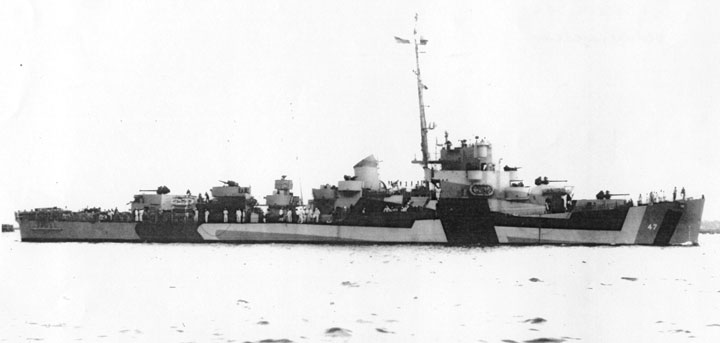
The serenity did not last. During the war the British and then the US navies had begun training up Chinese naval crews. In spring 1945 Washington approved the transfer of two destroyers, four minesweepers and two patrol craft to the ROC. The ships were sent to Miami for refitting where they were joined by over a thousand Chinese sailors. In the late spring of 1946, those trained crews sailed the ships back to China.[9] There they joined a former British corvette HMS Petunia which, in January 1946, had become the ROC Ship Fubo.[10]
In May 1946 a French ship inspected the Paracel Islands, visiting Pattle Island on the 26th, to reassert France’s pre-war claim to the islands. The navy report tells us that the French didn’t know what had caused the wartime destruction to the island.[11] Presumably the Americans hadn’t told them. Then, on 23 July (shortly after the Philippines became formally independent from the US) the Philippine Vice-President Elpido Quirino issued a declaration claiming the Spratly Islands.[12] In response, the RoC government began to take practical steps to assert its own claim.
Research by a Canadian postgraduate researcher, Chris Chung, has shed new light on what happened.[13] In 1946 the RoC Ministry of the Interior commissioned a ‘Location Sketch Map of the South China Sea Islands’ (Nanhai Zhudao Weizhi Lüetu南海諸島位置略圖). The resulting map included an 8-dash line stretching around the Sea and as far south as the James Shoal, just off the coast of Borneo. At this time, it appears the RoC believed the shoal was an island. In 1935 an RoC committee had translated its name as Zeng-mu (the transliteration of James) ‘Tan’ – where Tan means a sandbank. It was only in December 1947 that the cartographers realized their mistake and borrowed the literary word ‘Ansha’ to use as an equivalent to ‘shoal’.

The line the cartographer drew, incorporating this non-existent island and vast areas of sea, remains with us to this day. I have argued elsewhere that the shape of the line is a legacy of a series of ‘maps of national humiliation’ drawn by Chinese nationalists in the first half of the twentieth century.[14] As such it owes more to those nationalists’ misunderstandings about Southeast Asian history than it does to any real assertion of historic Chinese sovereignty. It’s a mistake now being forced upon the region with ideological rigour.
At a meeting on 26 September 1946, representatives of the RoC ministries of Foreign Affairs, Defence and Interior plus the Naval Headquarters ironed out details of China’s claim in the Sea. They agreed to follow the line drawn on the Interior Ministry’s map. They then resolved that, once the Executive Yuan had approved, the Guangdong provincial government would be put in charge of an operation to physically occupy the islands.
French diplomats heard rumours about the Chinese plans and the Paris government urged the colonial authorities in Indochina to get there first. A French minesweeper, the FR Chevreuil reached Itu Aba on 5 October 1946.[15] A landing party deposited a marker stone renewing France’s original annexation of the island (and five others) first publicized on 25 July 1933 (and about which China never protested[16]).[17] However, the High Commissioner of Indochina, Georges Thierry d’Argenlieu, was less concerned about the Paracels, preferring to deploy his forces against Ho Chi Minh’s Vietnamese nationalist movement instead.
By November 1946, the RoC navy included 41 older Chinese ships plus 82 transferred from the US and 9 from the UK.[18] The vast majority were small patrol boats and landing craft but a few were large enough to make the journey to the archipelagos. The historian Ulises Granados tells us that a flotilla arrived in Yulin harbour on Hainan Island on 8 November 1946.[19] Bad weather delayed the expeditions but after it passed, one group of ships, including the minesweeper Yongxing (formerly the USS Embattle) and the Zhongjian (formerly LST-716) and the Fubo, sailed to Woody Island in the Paracels, arriving on 24 November. Another, including the Taiping (formerly the USS Decker) and Zhongye (formerly LST-1056) sailed to Itu Aba, arriving on 12 December. For the first time in recorded history, a Chinese official set foot on one of the Spratly islands.

The French had got to Itu Aba first but they came second in the race to Woody Island. On 8 January 1947, a Chinese government spokesman announced the landing there and two days later the French sent a plane to check. When it reported that a Chinese unit was indeed in occupation, the French sent a ship, the Tonkinois, to try and force them to leave. Despite offers of money and even some firing in the air, the mission failed and the French retreated to Pattle Island instead.[20] A French, and later a Vietnamese, garrison would remain on Pattle Island until the Chinese invaded in 1974 – the ‘second battle of the Paracels’. The RoC garrison departed Woody Island in May 1950 after the communists occupied Hainan. PRC forces would arrive in 1955.
Although France had a much stronger claim to Itu Aba than China – by virtue of the 1933 annexation (and the RoC’s decision not to object) and its 1946 voyage – it failed to defend its position, and the RoC installed an occasional presence there. It too was evacuated in 1950 but Taiwanese forces were to return in 1956 and remain there, off and on, until today.
There are great ironies here. Firstly, the current Chinese names for Itu Aba Island – Taiping Dao – and Woody Island – Yongxin Dao – honour former American warships. Secondly, if the United States hadn’t supplied those warships, China would today have a much-reduced claim in the Paracels and probably no claim at all in the Spratlys.
What does this complex history mean for the various legal claims to the islands? It’s clear that France annexed and occupied six of the Spratlys well before China or any other country (except the UK, but we’ll ignore that here). However it did almost nothing to uphold its claim to them in the decades after it granted independence to Vietnam. If we take France (and Britain) out of the picture then the evidence we have at the moment would suggest ‘China’ has the strongest claim to Itu Aba. (However, given that the island is occupied by Taiwan, there’s a separate argument about which ‘China’ it is.)
But does that claim to Itu Aba give China rights over the rest of the Spratlys? Itu Aba is the largest of several features on the Tizard Bank, an area of raised seabed. However, since the early 1970s Vietnam has occupied Namyit Island – across the lagoon. Would a valid claim to Itu Aba give China a superior claim to the other features on the Bank too? Or should each feature be treated separately?
The question is multiplied when other features in the Spratlys are considered. All are separated from Tizard Bank – and most from one another – by deep sea. Would a claim to Itu Aba extend to other features too? Chinese officials have never occupied, administered or even stood on the vast majority of these islands, reefs and rocks so it seems unlikely that an international tribunal would regard the Chinese claim as superior to those of the other claimants.
This insight leads us towards a possible solution to the territorial disputes. In almost every case the current occupiers of each rock and reef in the Spratlys are the same countries whose forces first landed on them in the decades after the Second World War. They can easily prove continuous occupation since then. The Southeast Asian claimants (Malaysia, the Philippines and Vietnam) have come to an unwritten understanding that they will not seek to physically challenge the others’ claims. Could the same understanding be extended to China?
[1] Australian Commandos: Their Secret War Against the Japanese in World War II, A. B. Feuer. Stackpole Books, 2005
[2] United States Pacific Fleet, Patrol Bombing Squadron 128. Action report 3 May 1945
[3] Kit C. Carter and Robert Mueller, US Army Air Forces in World War II Combat Chronology 1941-1945. Center for Air Force History, Washington DC, 1991
[4] World War II War Diaries USS Sea Fox http://www.fold3.com/image/#301745082; USS CABEZON
http://www.fold3.com/image/#301980652; USS BUGARA http://www.fold3.com/image/#302085830
[5] US Office of Naval Intelligence Review. May 1956 p189. Quoted in David Muller, China as a maritime power p.80. Carter & Mueller ibid
[6] Ta Kung Pao [Da Gong Bao] (The Impartial) (Tianjin), 1 February 1947. Quoted in Granados (2006)
[7] Kimie Hara, Cold War Frontiers in the Asia-Pacific: Divided Territories in the San Francisco System. Routledge, 2006 pp.146-7
[8] US Office of Naval Intelligence, The Chinese navy, past and present. ONI Review, January 1947 pp21-29
[9] ONI Review, ibid
[10] Bruce Swanson, Eighth voyage of the dragon. Naval Institute Press, 1982. p.168-9
[11] Tonnesson Ibid p. 19
[12] Ulises Granados, Chinese Ocean Policies Towards the South China Sea in a Transitional Period, 1946–1952. The China Review, Vol. 6, No. 1 (Spring 2006) pp. 153–181
[13] Chris Chung, “Since Time Immemorial”:
China’s Historical Claim in the South China Sea.MA Thesis, Departent of History, University of Calgary, Alberta. September, 2013
[14] Bill Hayton, China’s false memory syndrome. ProspectMagazine.co.uk 10 July 2014.
[15] Stein Tønnesson, The South China Sea in the Age of European Decline. Modern Asian Studies 40, 1 (2006) pp. 1–57
[16] See Bill Hayton, Fact, Fiction and the South China Sea. Asia Sentinel May 2015 for more details on the absence of a Chinese protest.
[17] Journal Officiel de la Republique Francaise. 25 July 1933. p.7794 The six annexed islands were Amboyna Cay, Itu Aba, Loaita, North Danger (comprising Northwest Cay and Southeast Cay), Spratly and Thitu,
[18] ONI Review, ibid.
[19] Granados, ibid
[20] Tonneson ibid p.27